Port-aux-Français, French Southern Territories latitude longitude
Decimal latitude and longitude coordinates for Port-aux-Français (French Southern Territories): -49.35, 70.21667
More about Port-aux-Français Lat-Long position
Port-aux-Français is located in French Southern Territories country, in Africa continent (or region). DMS latitude longitude coordinates for Port-aux-Français are: 49°21'0"S, 70°13'0.01"E.
• Latitude position:
Equator ⇐ 5487km (3410mi) ⇐ Port-aux-Français ⇒ 4520km (2809mi) ⇒ South pole.
• Longitude position:
Prime meridian ⇒ 4893km (3040mi) ⇒ Port-aux-Français. GMT: +5h.
• Local time in Port-aux-Français: Wednesday 2:48 am, July 29, 2026. [*time info]
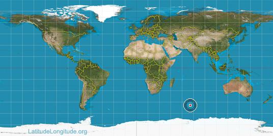
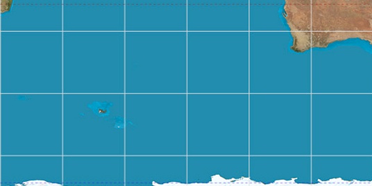

Step for grid lines is 15°. On second map -45° latitude and 75° longitude line is numbered. Map pointer shows the -49.35, 70.22 lat-long coordinates.
[*time info] Shown time is in moment when this page is generated. For more accurate time in Port-aux-Français visit timein.org (new window).
© 2015 - LatitudeLongitude.org Terms of use - programmed by Igi