Ar Rām wa Ḑāḩiyat al Barīd, Palestinian Territory latitude longitude
Decimal latitude and longitude coordinates for Ar Rām wa Ḑāḩiyat al Barīd (Palestinian Territory): 31.84945, 35.2342
More about Ar Rām wa Ḑāḩiyat al Barīd Lat-Long position
Ar Rām wa Ḑāḩiyat al Barīd is located in Palestinian Territory country, in Asia continent (or region). DMS latitude longitude coordinates for Ar Rām wa Ḑāḩiyat al Barīd are: 31°50'58.02"N, 35°14'3.12"E.
• Latitude position:
Equator ⇐ 3541km (2200mi) ⇐ Ar Rām wa Ḑāḩiyat al Barīd ⇒ 6466km (4018mi) ⇒ North pole.
• Longitude position:
Prime meridian ⇒ 3313km (2058mi) ⇒ Ar Rām wa Ḑāḩiyat al Barīd. GMT: +3h.
• Local time in Ar Rām wa Ḑāḩiyat al Barīd: Friday 11:34 pm, July 24, 2026. [*time info]

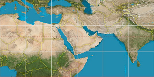

Step for grid lines is 15°. On second map 30° latitude and 30° longitude line is numbered. Map pointer shows the 31.85, 35.23 lat-long coordinates.
[*time info] Shown time is in moment when this page is generated. For more accurate time in Ar Rām wa Ḑāḩiyat al Barīd visit timein.org (new window).
© 2015 - LatitudeLongitude.org Terms of use - programmed by Igi