Agnibilékrou, Ivory Coast latitude longitude
Decimal latitude and longitude coordinates for Agnibilékrou (Ivory Coast): 7.13113, -3.20415
More about Agnibilékrou Lat-Long position
Agnibilékrou is located in Ivory Coast country, in Africa continent (or region). DMS latitude longitude coordinates for Agnibilékrou are: 7°7'52.07"N, 3°12'14.94"W.
• Latitude position:
Equator ⇐ 793km (493mi) ⇐ Agnibilékrou ⇒ 9214km (5725mi) ⇒ North pole.
• Longitude position:
Agnibilékrou ⇐ 354km (220mi) ⇐ Prime meridian. GMT: 0h.
• Local time in Agnibilékrou: Tuesday 10:31 pm, July 28, 2026. [*time info]

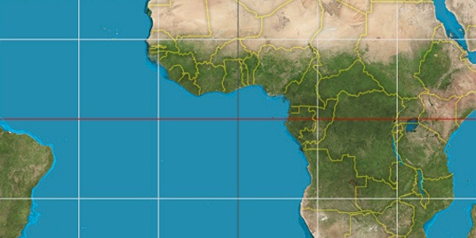

Step for grid lines is 15°. On second map 0° latitude and -0° longitude line is numbered. Map pointer shows the 7.13, -3.2 lat-long coordinates.
[*time info] Shown time is in moment when this page is generated. For more accurate time in Agnibilékrou visit timein.org (new window).
© 2015 - LatitudeLongitude.org Terms of use - programmed by Igi